Description (~200 words)
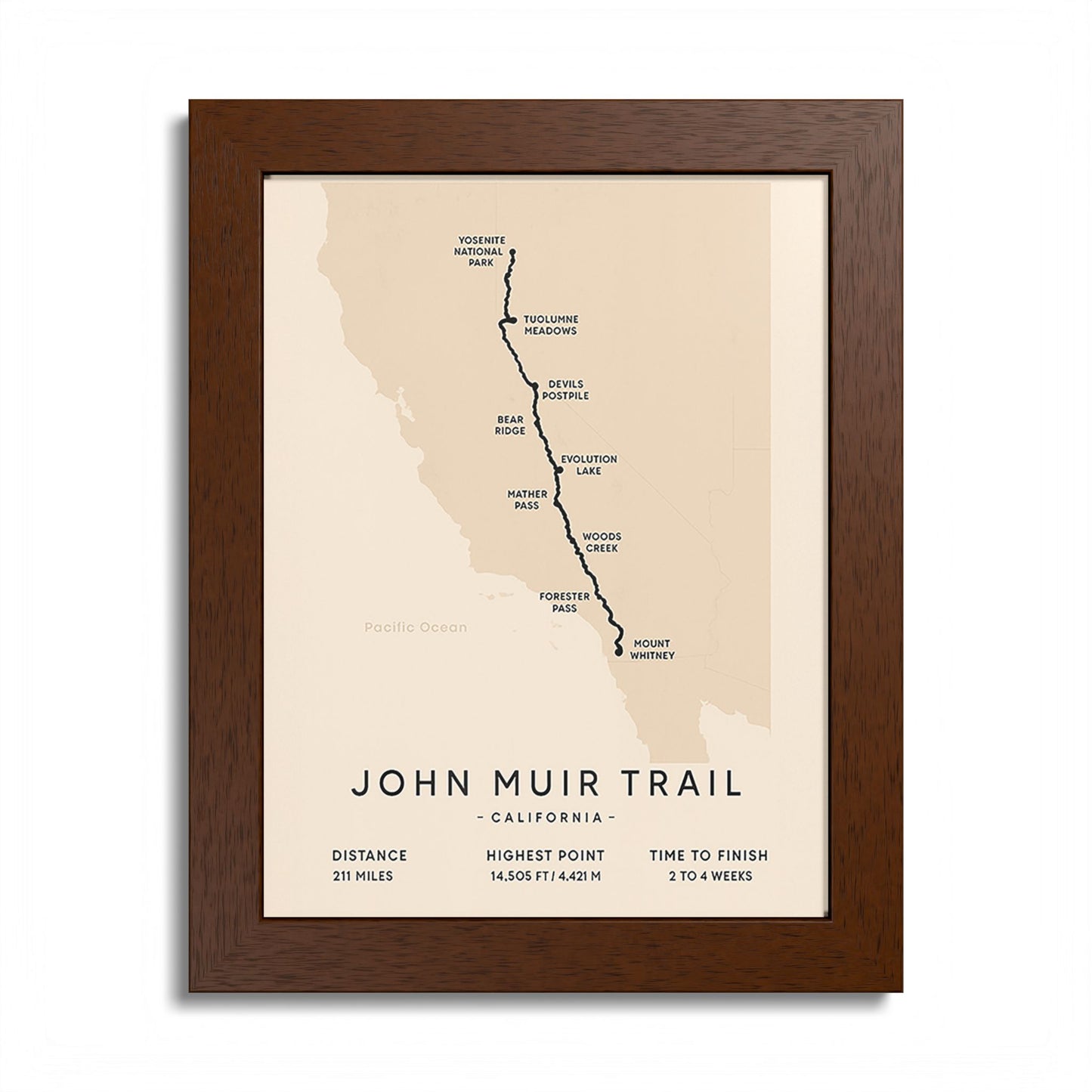
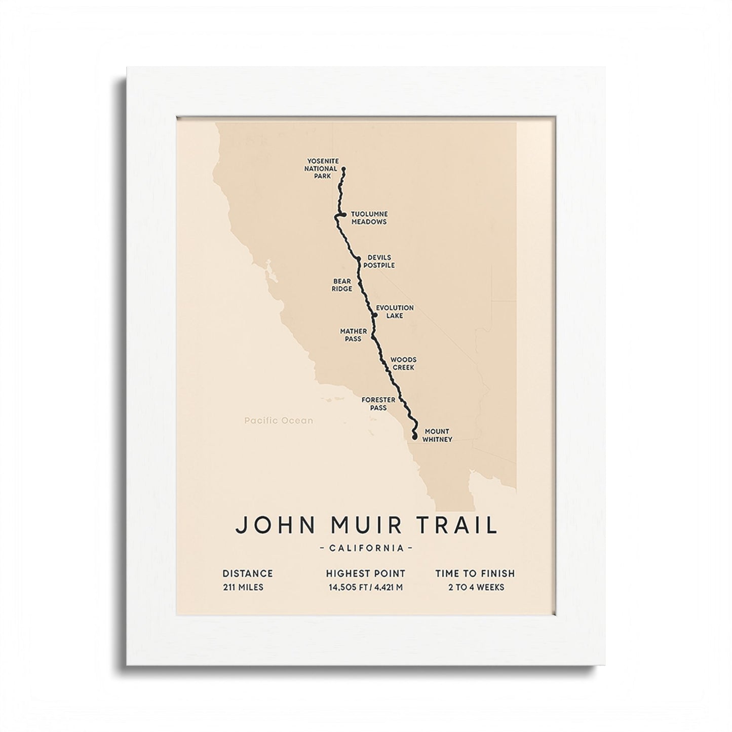
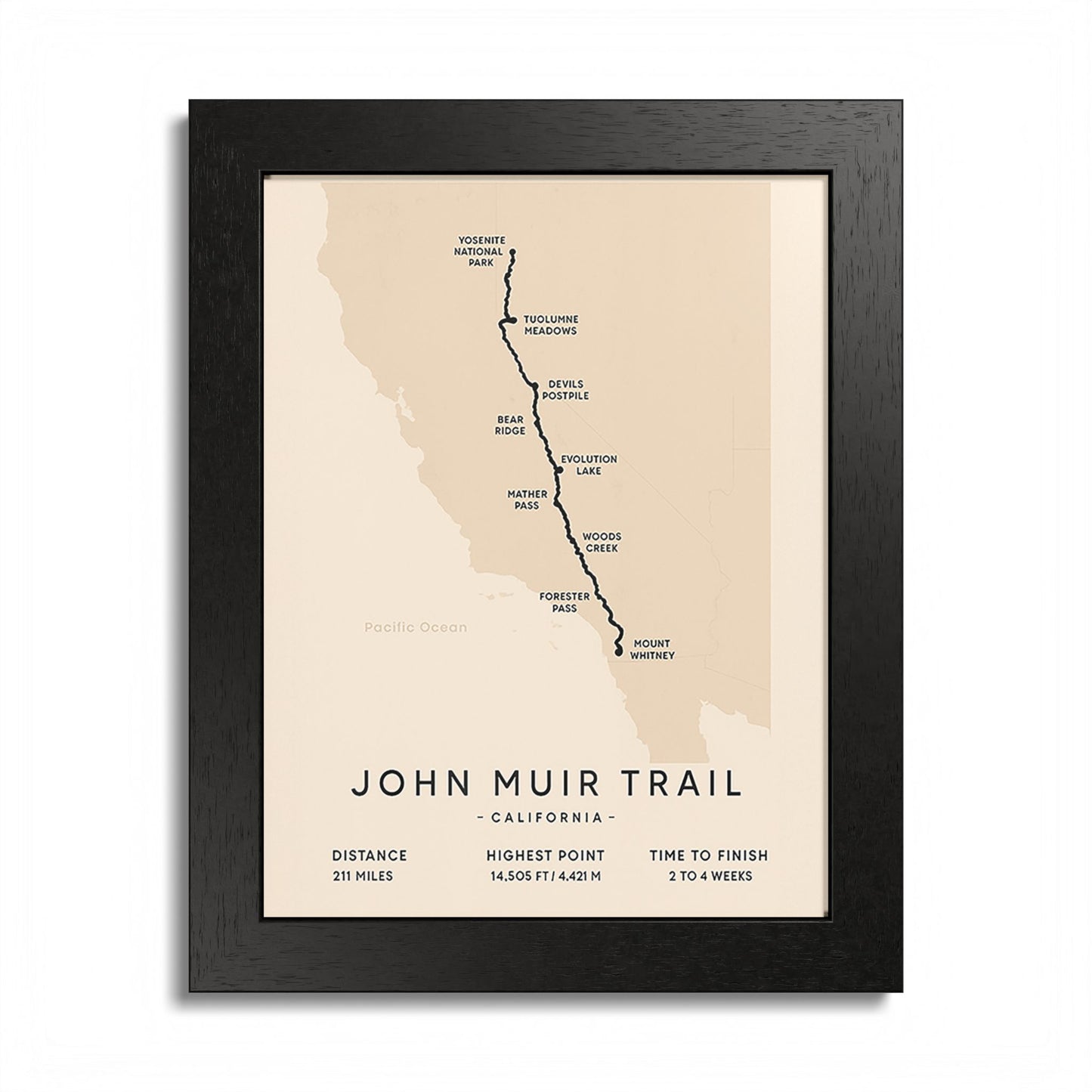
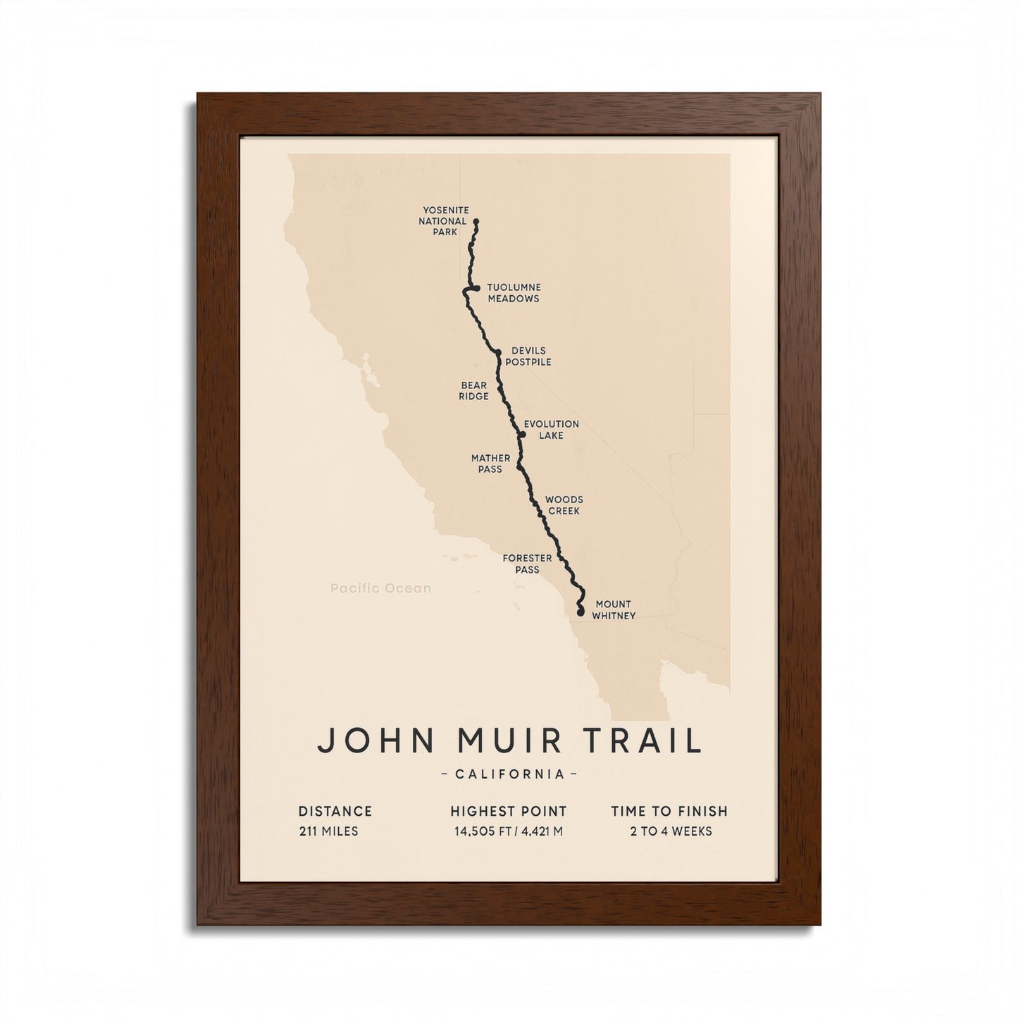
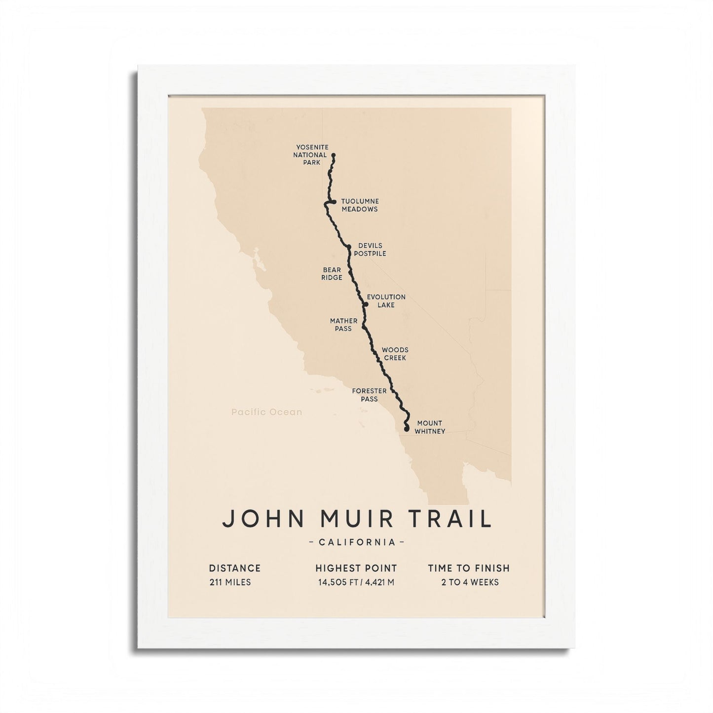
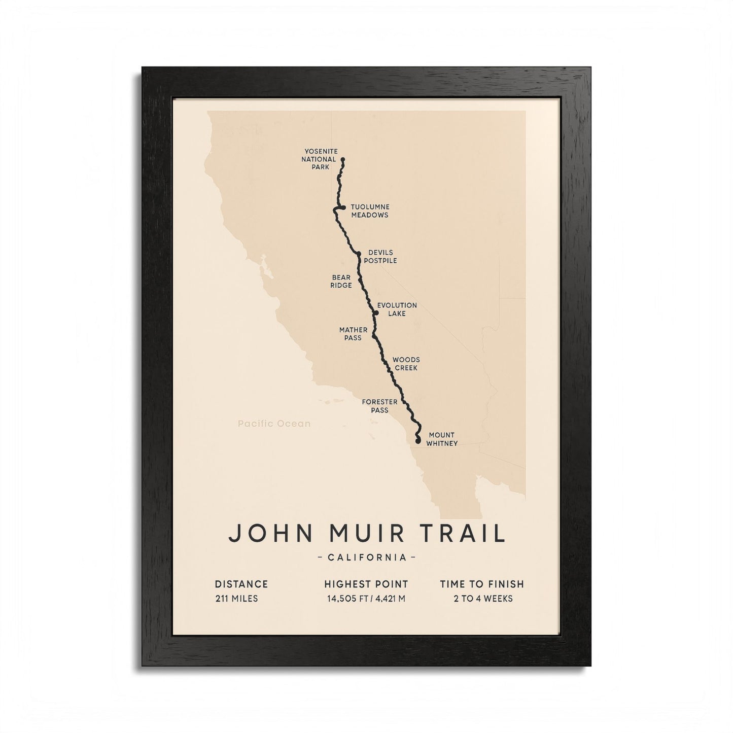
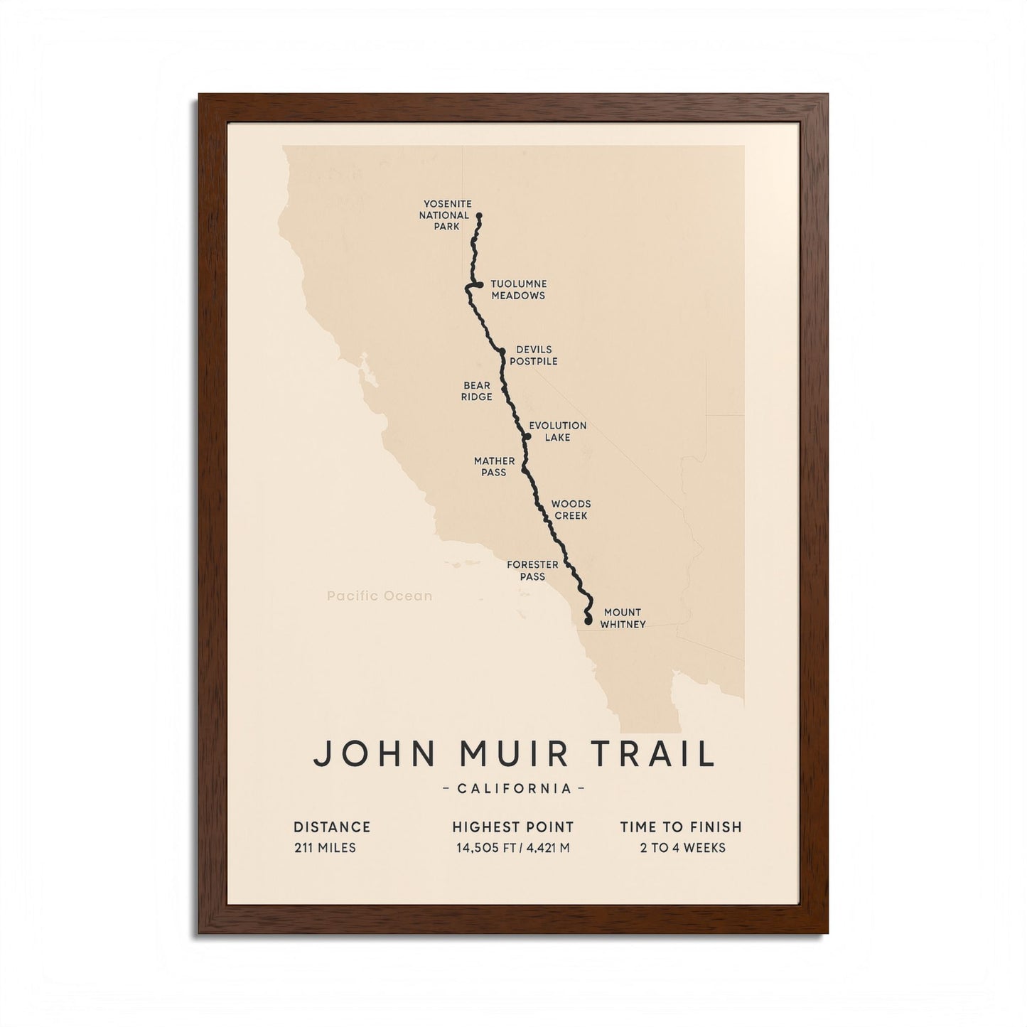
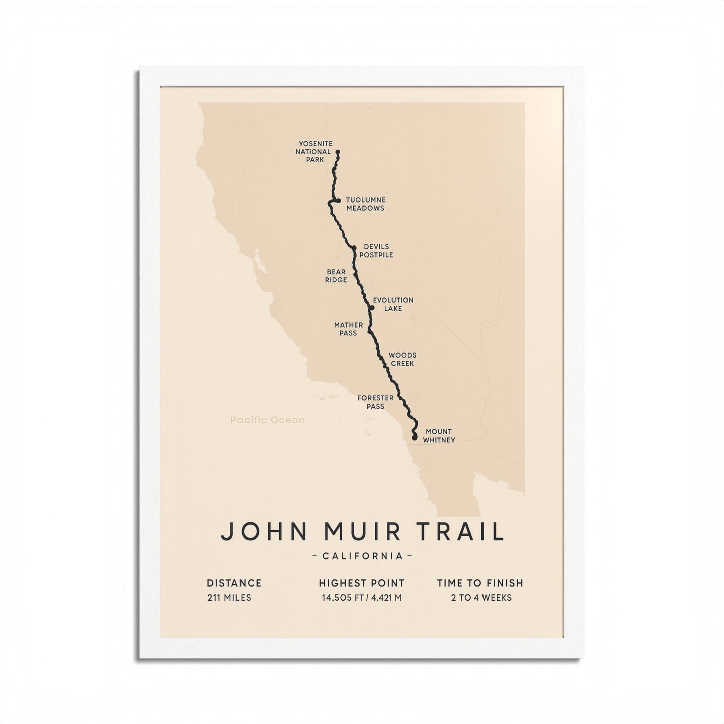
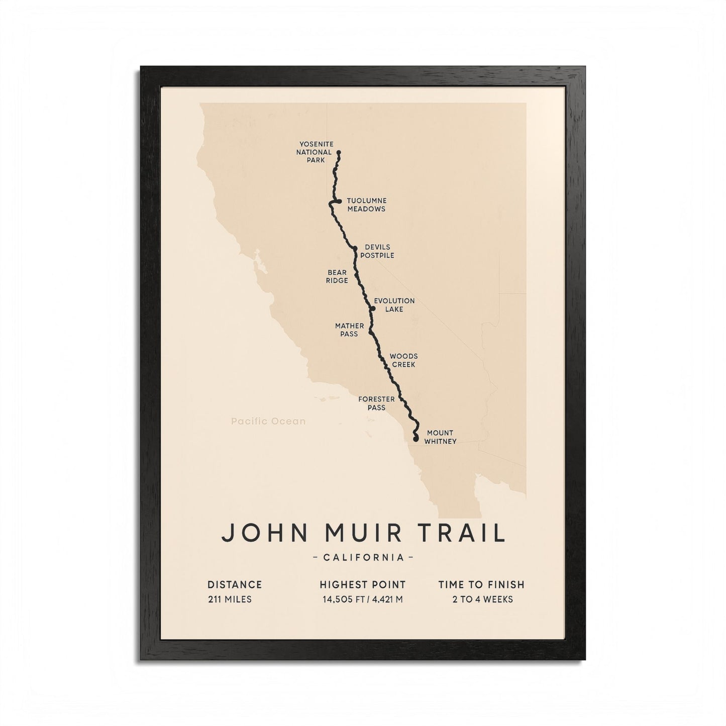
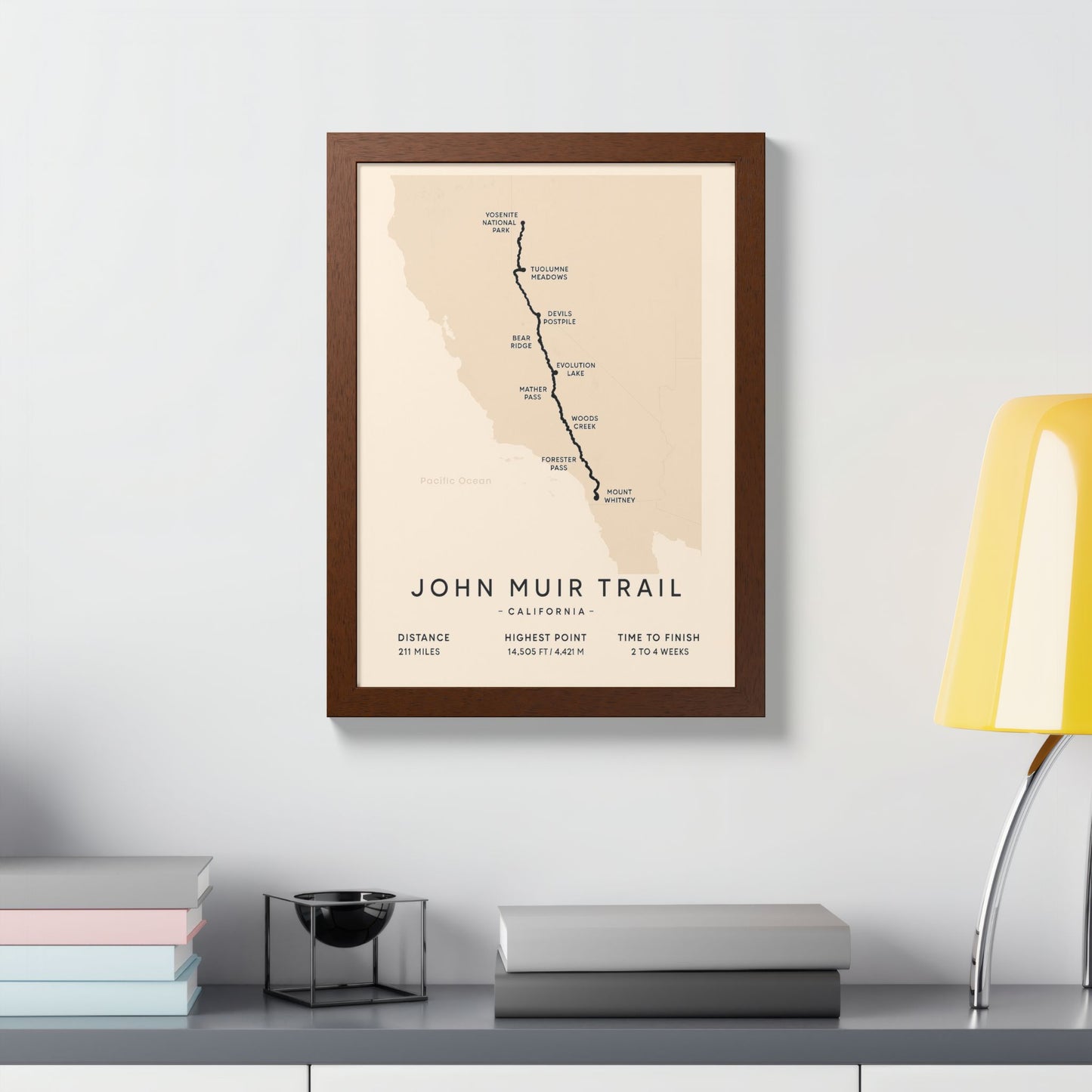
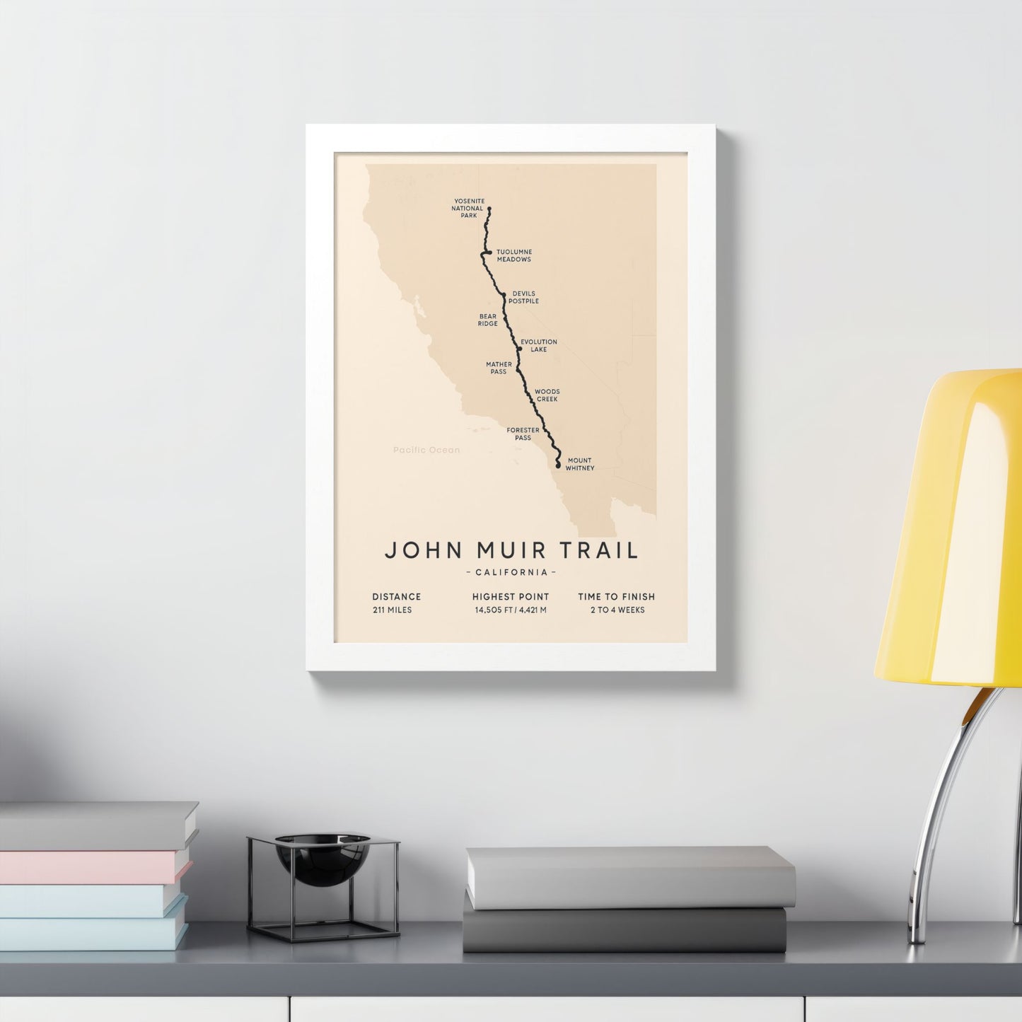
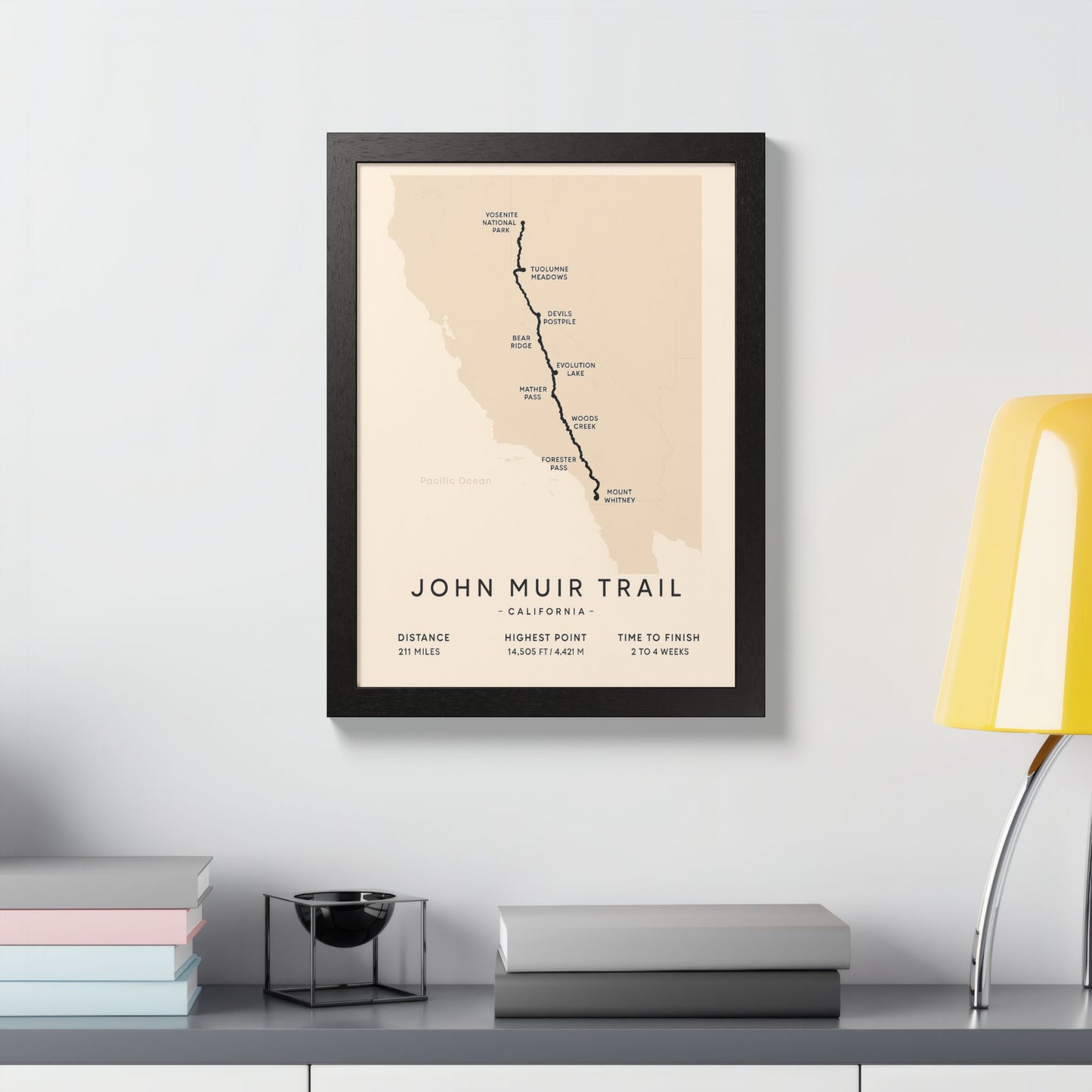
Celebrate the iconic John Muir Trail with a clean, minimalist route map crafted for hikers and Sierra Nevada lovers. The bold line traces the full 211-mile journey from Yosemite National Park to Mount Whitney, with classic waypoints—Tuolumne Meadows, Devils Postpile, Evolution Lake, Woods Creek, Mather Pass, Forester Pass—labeled for a quick read. A soft topo backdrop and refined typography let the trail take center stage while fitting easily into modern, rustic, or Scandinavian décor.
Specs
• Distance: 211 miles • Highest point: 14,505 ft / 4,421 m
• Typical time: 2–4 weeks
• Printed with archival inks on premium matte paper
• Optional frames in Black, White, Natural Oak with crystal-clear cover
• Multiple vertical sizes for office, hallway, or gear room
Why it works
A timeless statement piece for anyone who’s hiked the JMT—or dreams to. It pairs beautifully with national park and summit prints and makes a thoughtful gift for hikers, backpackers, and California trail fans.
How to order
Choose your size and (if desired) frame color from the options. Your print is made to order and arrives ready to hang or gift.
Product features
- Vibrant colors for an eye-catching display.
- Ready to hang with included hanging kit.
- Made from high-quality 200 gsm semi-gloss coated paper.
- Available in both horizontal and vertical orientations.
- Hand-crafted wooden frame for a premium finish.
Care instructions
- If the poster does gather any dust, you may wipe it off gently with a clean, dry cloth.